 1: Introduction
Cartographers use a multi-disciplinary approach to design the best possible map for a given purpose and a given audience.
Cartographers apply many design principles when compiling their maps and constructing page layouts. Five of the main design principles are legibility, visual contrast, figure-ground, hierarchical organization, and balance. Together these form a system for seeing and understanding the relative importance of the content in the map and on the page.
1: Introduction 2: Visual Hierarchies
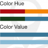 3: Practice with Visual Hierarchy Copy
3: Practice with Visual Hierarchy
3: Practice with Visual Hierarchy Copy
3: Practice with Visual Hierarchy 4: Visual Variables
 5: Visual Variables Practice
 5.5: Loading data into ArcMap
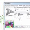 6: Symbology Tab, Part 1
 7: Symbology Tab, Part 2
 8: Elements and Export