 1: The Vector Data Model
Vector data consists of points, lines, or polygons, and the attributes that describe them.
The vector data model is one of two primary ways to represent landscape features in GIS. This module presents some of the fundamental tools for analyzing vector data.
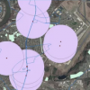
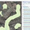
1: The Vector Data Model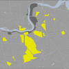 3: Select large, residentially zoned parcels
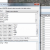
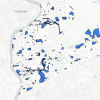 4: Select by Attributes Practice
 9: Select parcels that fall within the “erase” layer